By Rebecca Stephenson
Originally published in Desert Rivers Audubon Magazine
Desert Rivers Audubon Society was awarded an $8,000 Audubon in Action from the National Audubon Society in May 2024. The grant raises our financial commitment to the erection of a Motus Wildlife Tracking System receiving tower in Gilbert Riparian Preserve to $10,000. This project, a partnership with the Town of Gilbert, expands the Motus telemetry network in Arizona. Data collected by the Gibert tower will support ground-breaking migration research.
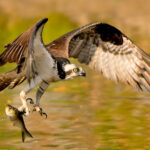
Studying birds has always been an extraordinary challenge. Yes, we occasionally manage to capture them and band them. But, once released, they zip back to the sky in a flurry of feathers, vanishing into the ether until they are hopefully recaptured one day. While biological science has certainly come a long way in the last several decades, exactly where birds go and what they do on their long journeys still remains kind of a mystery.
Counts and mark-recapture surveys have taught us much about birds and their migrations, but, from our place on the ground, we can only ever get so far. To see more than fleeting snapshots of their impressive voyages, we need a way to fly along with them. And that’s exactly what the ambitious Motus Wildlife Tracking System allows us to do.
Started by the non-profit conservation organization Birds Canada in 2014, Motus – Latin for “movement” – seeks to track the precise travels of birds and other winged creatures, like bats, bees, and monarch butterflies, through digital radio telemetry. While it might sound complicated, it’s actually a pretty simple process, at least in theory.
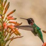
Birds and other winged creatures are carefully outfitted with small lightweight transmitters, called nanotags, which are attached using minimalistic harnesses or glue. Then, they are released with no need for recapture. Every few minutes, the transmitter on the animal’s back sends a unique ping out into the universe on a shared radio frequency. These pings transmit in a 12-mile radius around the creature as it goes about its life. Motus tower stations tuned to this frequency then pick up the pings and relay the data to the database headquarters in Canada, where it is processed, analyzed, and shared with researchers.
This “set it and forget it” aspect of Motus technology puts it leaps and bounds beyond the more commonly used tracking methods, which either rely on a GPS or geolocator tracking device storing data over time or a person following an animal around with a handheld receiver. In order for stored data to be useful, the tracking device has to eventually be recovered, which involves recapturing the animal it’s attached to. Meanwhile, gathering handheld receiver data requires long hours in the field. That’s a lot of variables at play, especially when you consider that if a tracker is lost, so is all that data.
Of course, things don’t always go off without a hitch with Motus. First, there is the matter of the transmitters themselves. Larger units are solar-powered, which eliminates the concern for dead batteries. But the smaller units – necessary for petite songbirds, hummingbirds, bees, and butterflies – must rely on battery power. And once that runs out, so does the data stream. Data communication also stops if the animal dies or the apparatus falls off – both of which can be expected out in nature.
Then, there are the tower stations. Essentially just small antennae arrays connected to a receiver and power supply, each Motus station detects pings from any transmitter within a nine-mile radius in optimal conditions. While impressive, that’s still pretty limiting as far as being a wide-ranging migration tool goes. As you might imagine, effectively tracking wildlife in real time requires a lot of stations – the more the better. These stations must be installed and then diligently maintained, which is a difficult job considering that they are often placed in remote locations, subjected to environmental havoc like lightning, and sometimes rendered inoperable by the teeth of wild animals.
But it’s all worth it. Over time, this data stream paints a complete picture of each animal’s movements: where it goes, how fast it travels, where it stops to rest and for how long, and where it ends up. Such data points can tell us a lot about how birds and other animals migrate, such as what areas they rely on during stopovers, how long they stay at each spot, and when exactly they begin and end their journeys. It can also expand on the nuances of migration and tell us what specific populations do.
All that said, Motus is still in its infancy – though it’s growing rapidly through international collaboration. As of 2023, over 1,500 Motus tower stations have been deployed in a total of 31 countries, including Canada, the United States, Mexico, Chile, Australia, and the United Kingdom. It’s successfully tracked over 34,000 individual tagged animals, providing migration data on around 250 species of birds, bats, and insects that have been incorporated into over 400 research projects.
So far, Motus has shed light on the lives of imperiled migrating shorebirds, like the Pacific Red Knot, fleshed out the nocturnal migration habits of threatened Snowy Plovers in the Midwest, and taught us more about how endangered Tricolored Blackbirds use key areas of central California. It is also helping researchers monitor the movements of declining grassland birds, mysterious birds like the Lewis’s Woodpecker, and imperiled monarch butterfly populations across the U.S.
Because many bird species breed in one country and spend their winters in another, biologists are also relying on Motus to identify potential problems the birds face at both ends of their full annual range. As part of a study on Wood Thrushes, for example, researchers discovered that the specific birds they had tagged in Costa Rica and Nicaragua in 2022 bred in the northeastern United States and southeastern Canada the following summer.
It’s this sort of highly specific data that tells biologists precisely how each and every bird survives year to year – and what exact estuaries, refuges, parks, or farmlands they are using to make it happen. It will also show what places birds avoid when traveling. Over time, such data can be used to identify and protect areas that are essential to the birds’ survival. It’s already proving to be a powerful conservation tool – but the more the merrier!
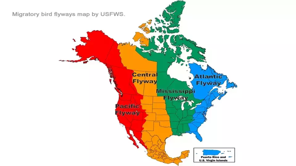
As of 2023, Arizona only has a modest handful of three Motus tower stations – including one attached to a defunct windmill – though that is changing. Plans are currently in the works to build more towers, possibly even putting one at the Gilbert Riparian Preserve, and outfit more birds with transmitters. And that’s where we come in. Arizona held its first Motus Tag Application Certification training course to teach volunteers how to safely handle and tag birds in February 2023 and plans to host many more in the coming months.
Running Motus takes a village. Biologists and certified volunteers must capture and attach transmitters to animals, IT technicians must keep the current network of towers operational and install new ones, and many researchers must work together to make sense of all the data coming in.
Ultimately, it’s all a numbers game: The more airborne transmitters are deployed and the more towers there are to pick up their signals, the more complete our picture of bird and other wildlife migration patterns will be. As Rich Schramm, a Motus volunteer in Oregon, explained to the U.S. Fish and Wildlife Service in May 2023: “The technology is there. We just need to get the word out.”